Equipment Setup
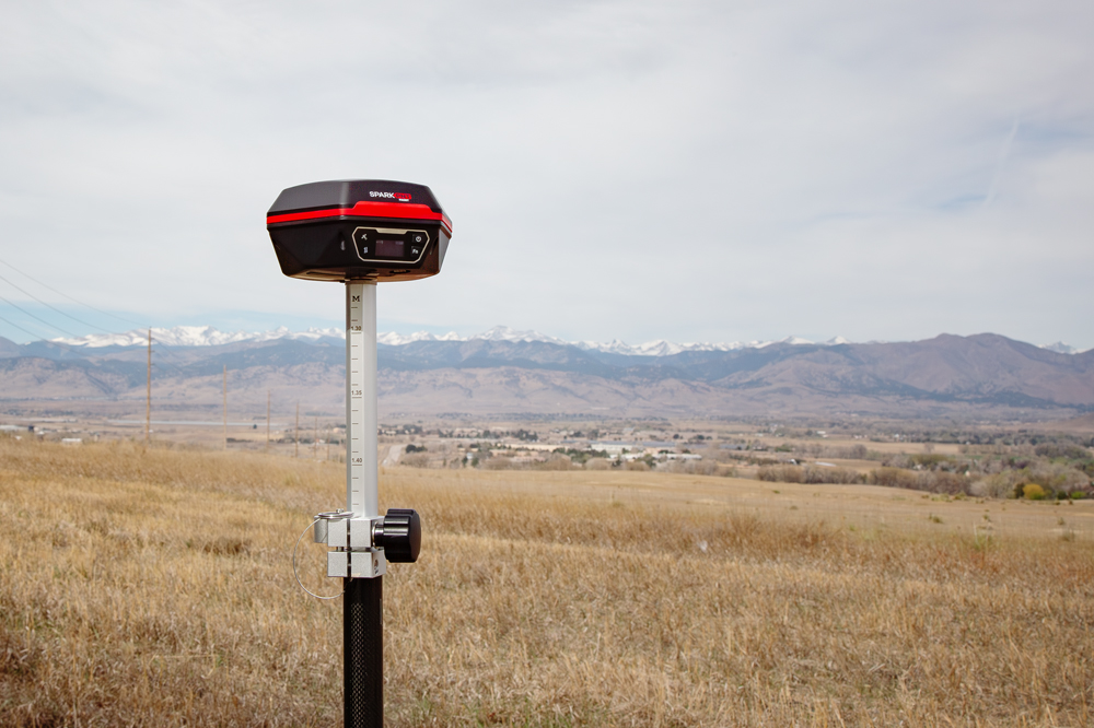
Time to get the FPL outside with a clear view of the sky!
The FPL has a standard 5/8" 11-TPI threaded base and is compatible with most surveying equipment. Users may elect to mount their mobile device (i.e. phone, laptop, or tablet) to the surveying equipment for ease of operation.
Orientation and Alignment
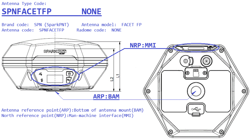
For the most accurate positioning, users should align their device as vertically straight as possible using a bubble level or other leveling technique. For extreme accuracy, the FPL was calibrated by the NGS having the user interface (the device's display) facing north as defined by the device's north reference point.
To correctly capture the altitude of points of interest, users should provide the pole height and distance between the ARP and APC to their GIS app. This will allow the altitude of the gathered point to be correctly calculated to the pole's point location on the ground. The FPL's antenna phase center (APC) is 58.3mm. Most users will extend their pole to 1.8m, so the resulting instrument height is 1.8m + 0.058m = 1.858m.
Placement and Surroundings
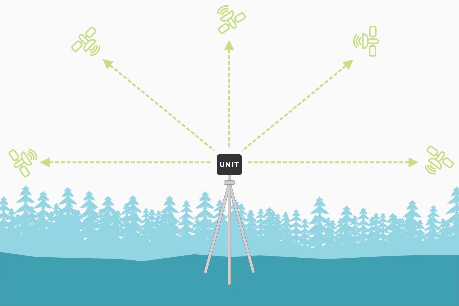
This section provides general placement considerations for accurate GNSS surveying. Below, are some useful examples of ideal locations for surveying.
- Ideal locations
- Open fields
- Hilltops
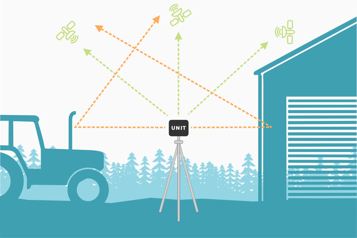
- Poor locations
- Canyons and valleys
- Cities or dense urban areas
- Dense foliage
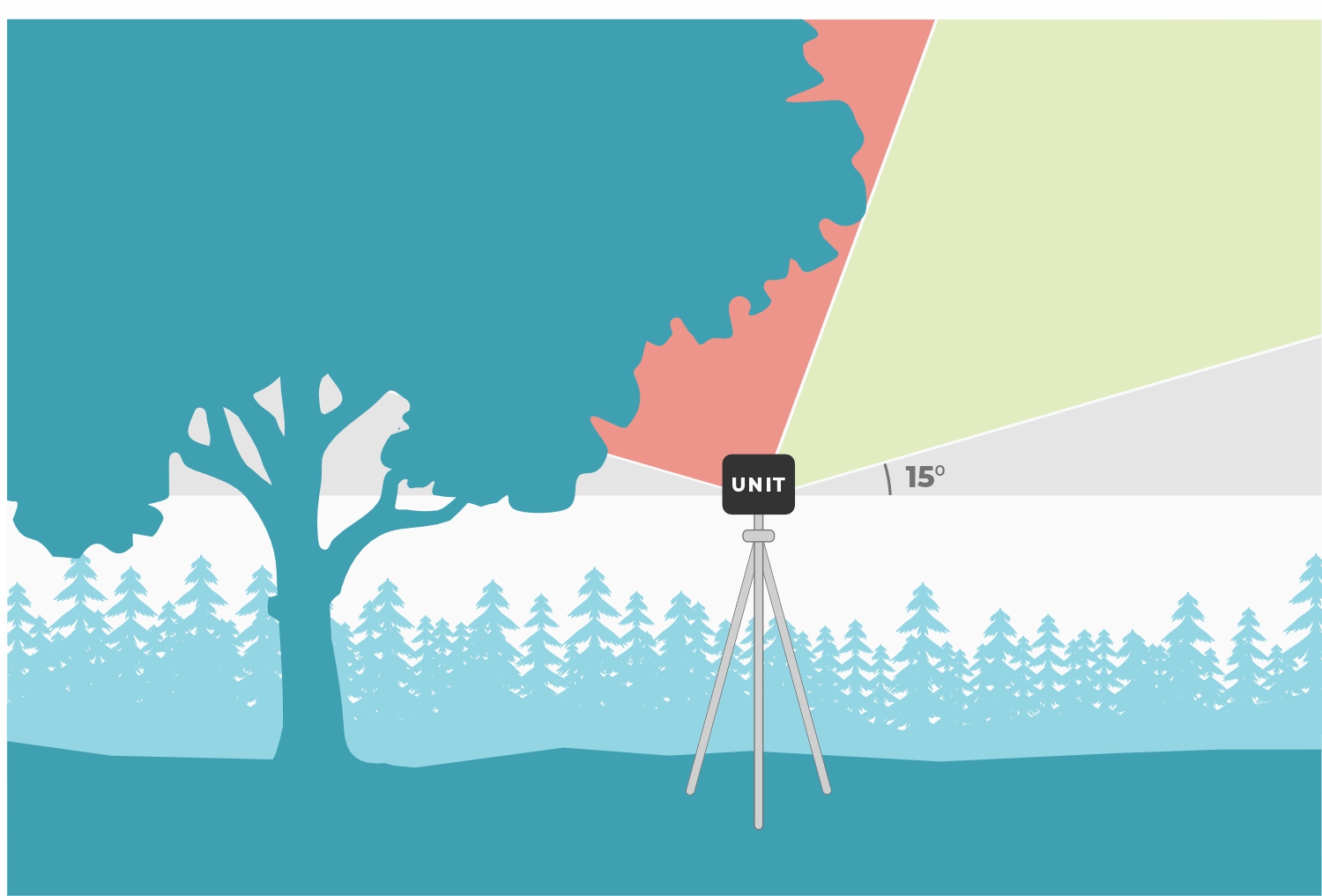
Obstructions and Multipath
For accurate GNSS surveying, the receiver works best with a wide-open, unobstructed view of the sky.
Obstructions can bounce signals causing 'multipath' errors. This introduces timing errors decreasing the accuracy of the receiver.
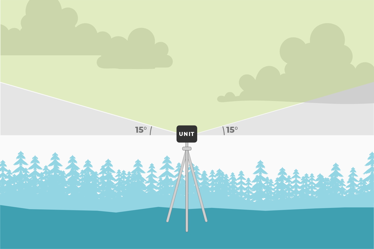
All satellite signals must pass through the Earth's atmosphere. Any disturbance in that path (ionospheric turbulence) adds to solution errors. By default, the FPL ignores any signals from satellites positioned below, 15° above its horizon (see image). This helps reduce errors introduced from signals from low satellites having to pass through the thicker atmosphere. This setting can be increased to remove additional low lying signals as needed.
Obstructions can also reduce the strength of incoming satellite signals. By default, the FPL ignores signals lower than 10dBHz. This helps reduce errors introduced from weak signals. This setting can be increased to remove additional low signal strength satellites as needed.
Dilution of Precision
The geometric arrangement of satellites, significantly influences the accuracy of GNSS solutions. A well-distributed arrangement of satellites allows for more accurate positioning by minimizing errors related to signal distortion and multipath effects. When satellites are positioned at wide angles relative to each other, the geometric dilution of precision improves, enhancing accuracy of the positioning solutions. Conversely, when satellites cluster closely together in the sky, it can lead to degradation in the geometric dilution of precision and less reliable positioning solutions. Therefore, optimal satellite geometry is crucial for achieving high-accuracy GNSS solutions.