Diamond Maps
Diamond Maps Offline is a GIS app that allows Diamond Maps users to download their maps from the cloud to their mobile device for use offline. With the app, users can collect new points, take pictures, directly connect to a Bluetooth GNSS device, and then upload the data to the Diamond Maps server.
For $20/month this GIS app supports many features and is a great solution for utilities and municipalities. Be sure your device is paired over Bluetooth. Once installed, users must login to open a project.
Make sure the FPX-T is switched on and operating in Rover mode. Also, make sure that Bluetooth is enabled in the settings of your mobile device.
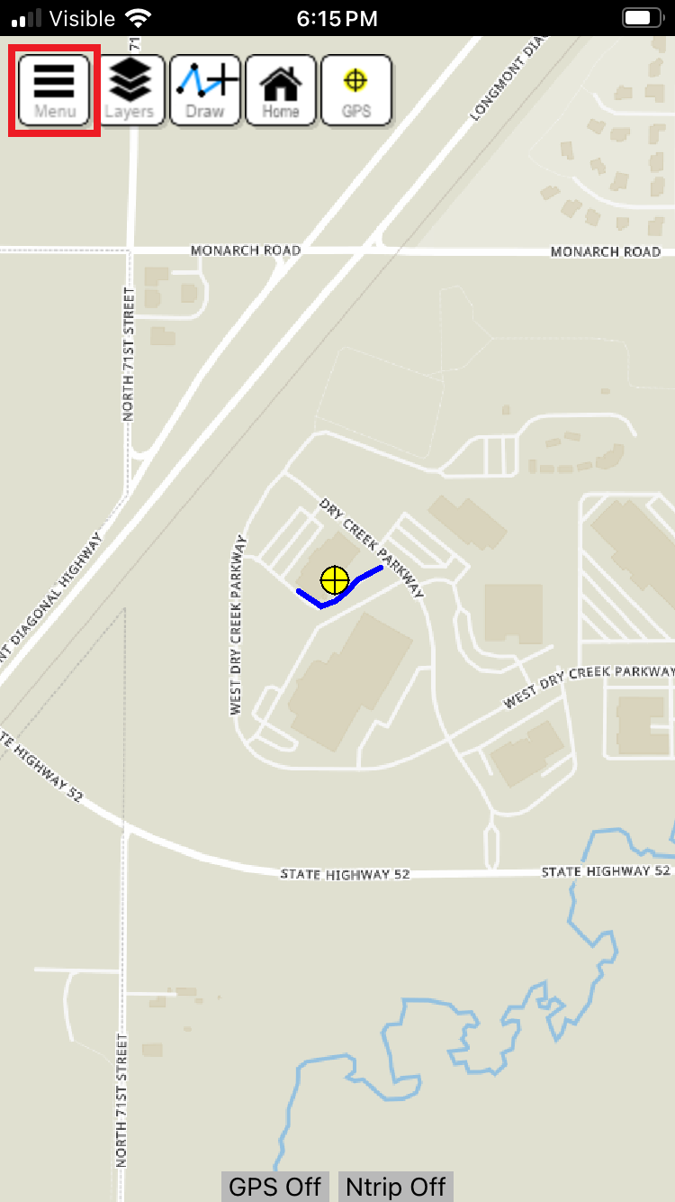
From the Home Screen, click on the hamburger button to open the main menu.
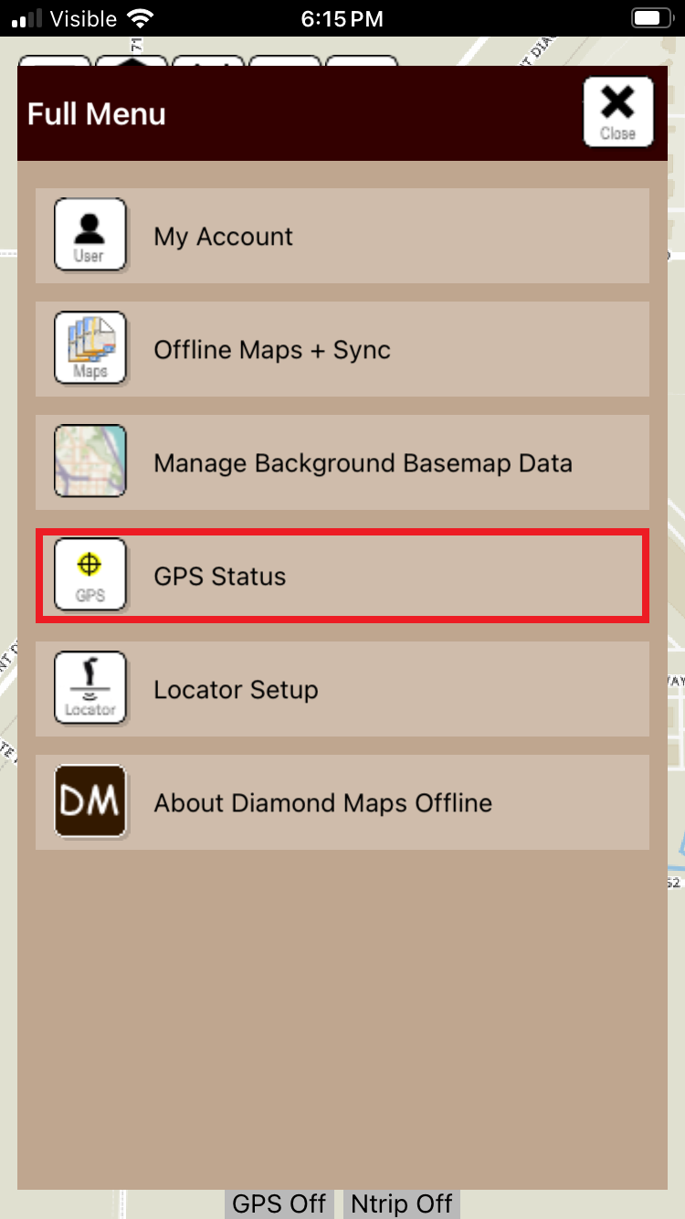
Press GPS Status to open the GPS Setup settings.
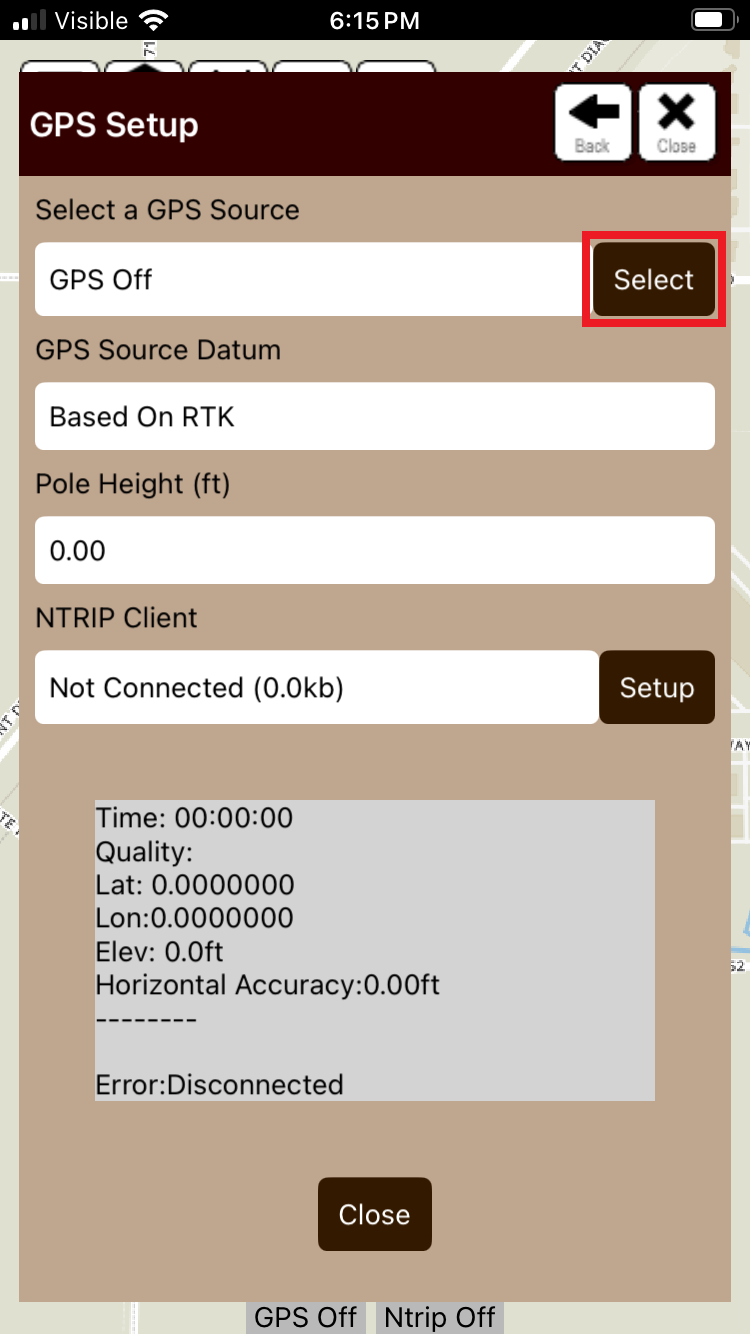
Press Select button to select a GPS ssource.
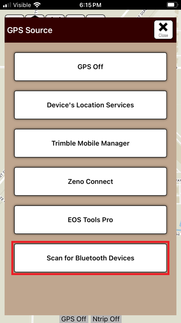
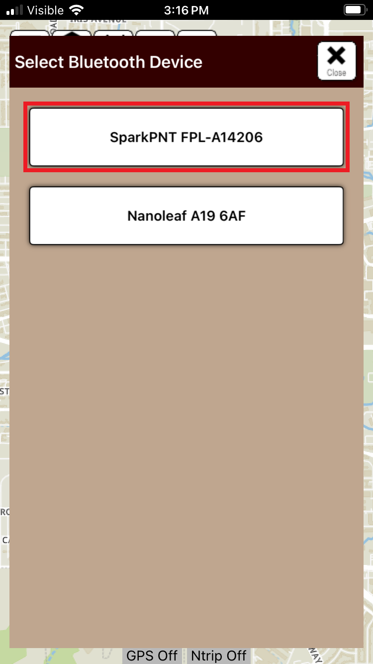
Select the Scan for Bluetooth Devices option; then, select the FPX-T that was previously paired with.
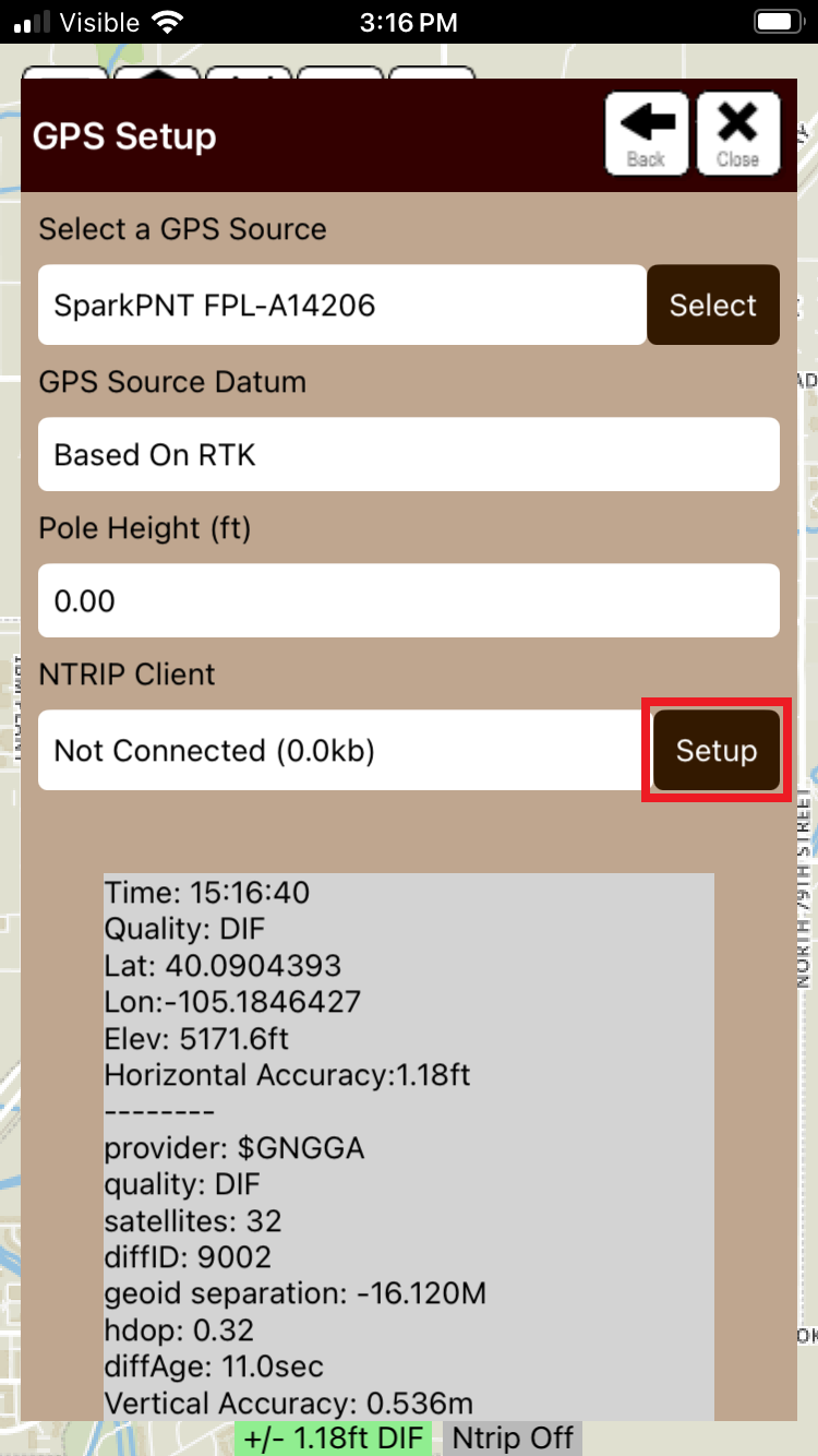
Once the FPX-T is connected, its status will be displayed in the window. As shown above, its DGPS accuracy is ~1.2'; however, this can be improved with RTK corrections. Click the Setup button to configure the NTRIP client.
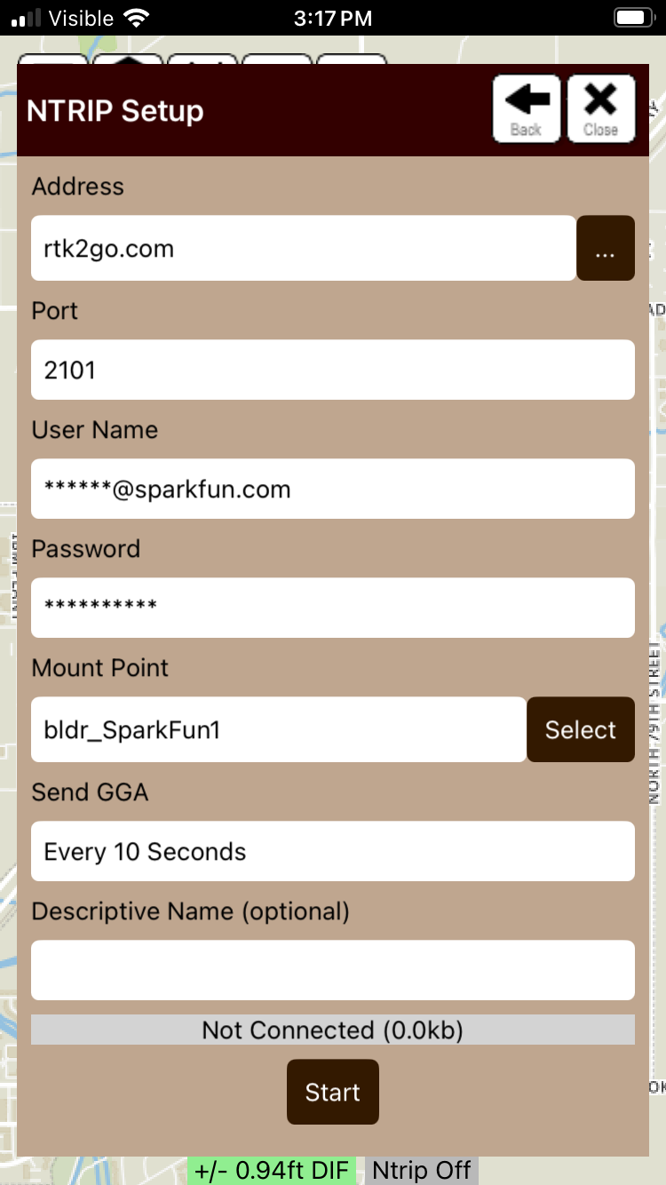
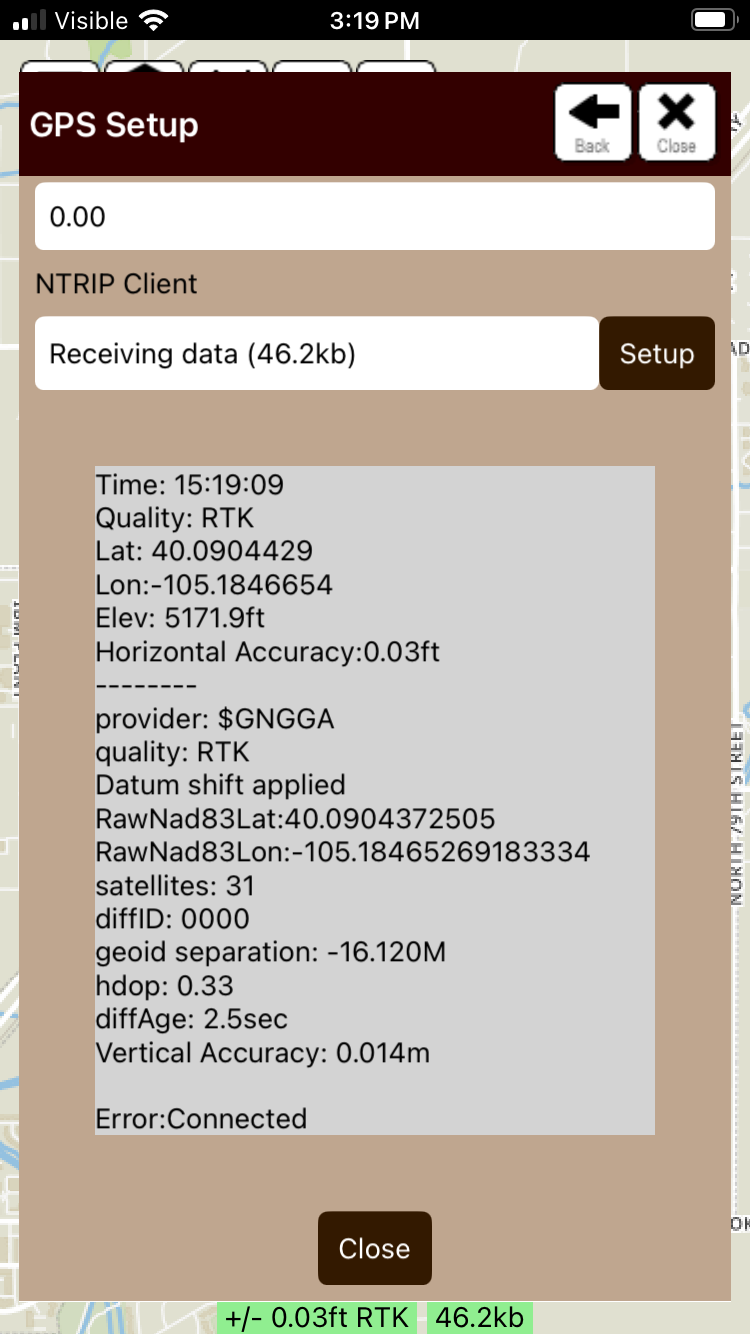
Enter the credentials for the NTRIP client and select a mount point. Press the Start button to establish a conncetion with the NTRIP caster; then, click Close button to exit.
Verify the Send GGA configuration, most RTK services require a GGA message be sent every 10 to 30 seconds.
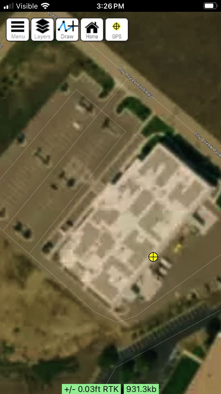
Return to the home screen and view the location. Note the accuracy is excellent at 0.03ft.